
SDG&E's lines
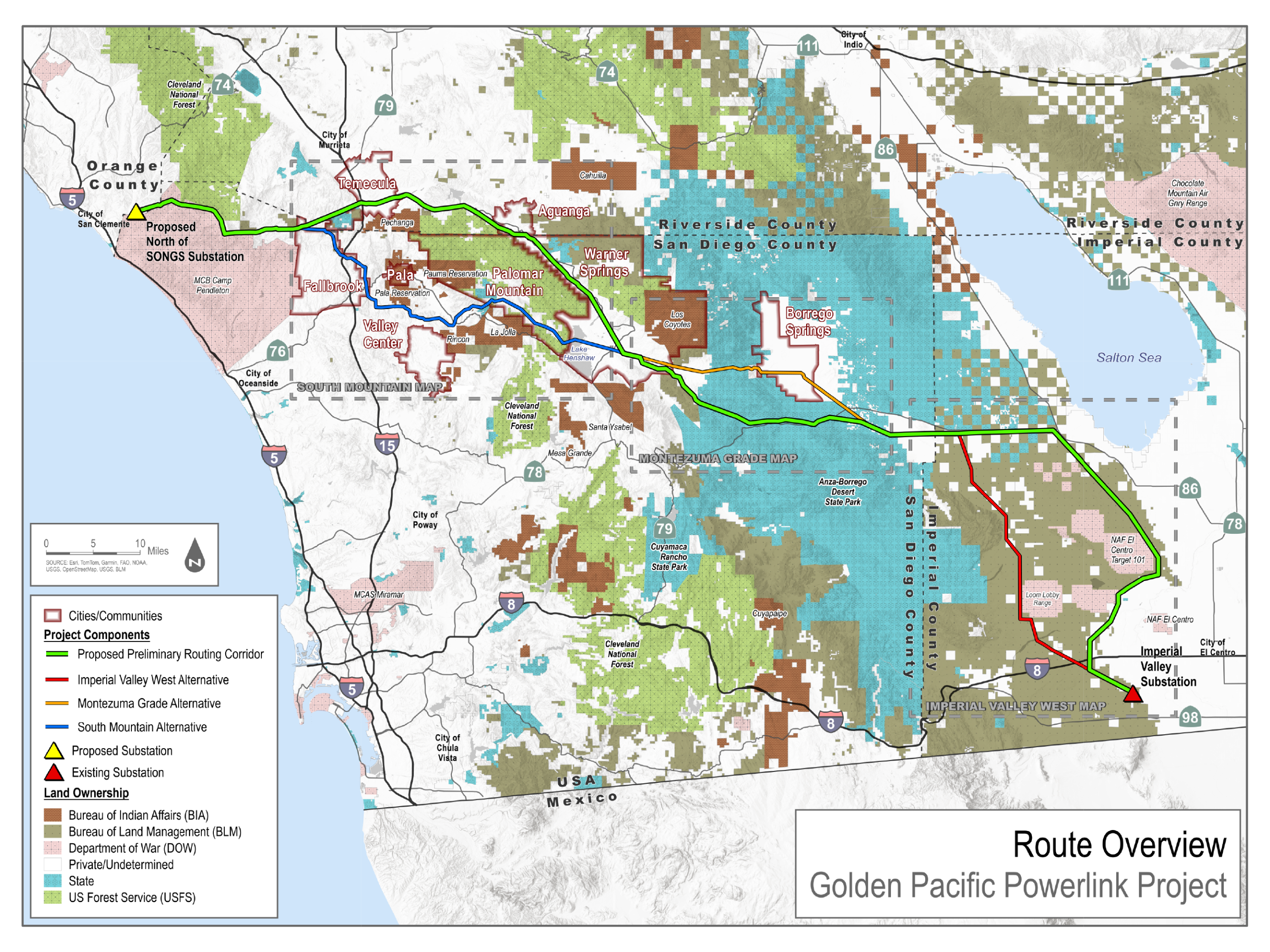
- Proposed preliminary routing corridor
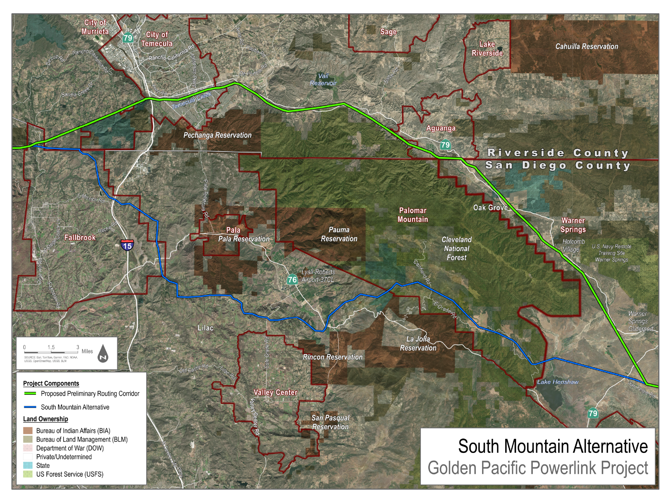
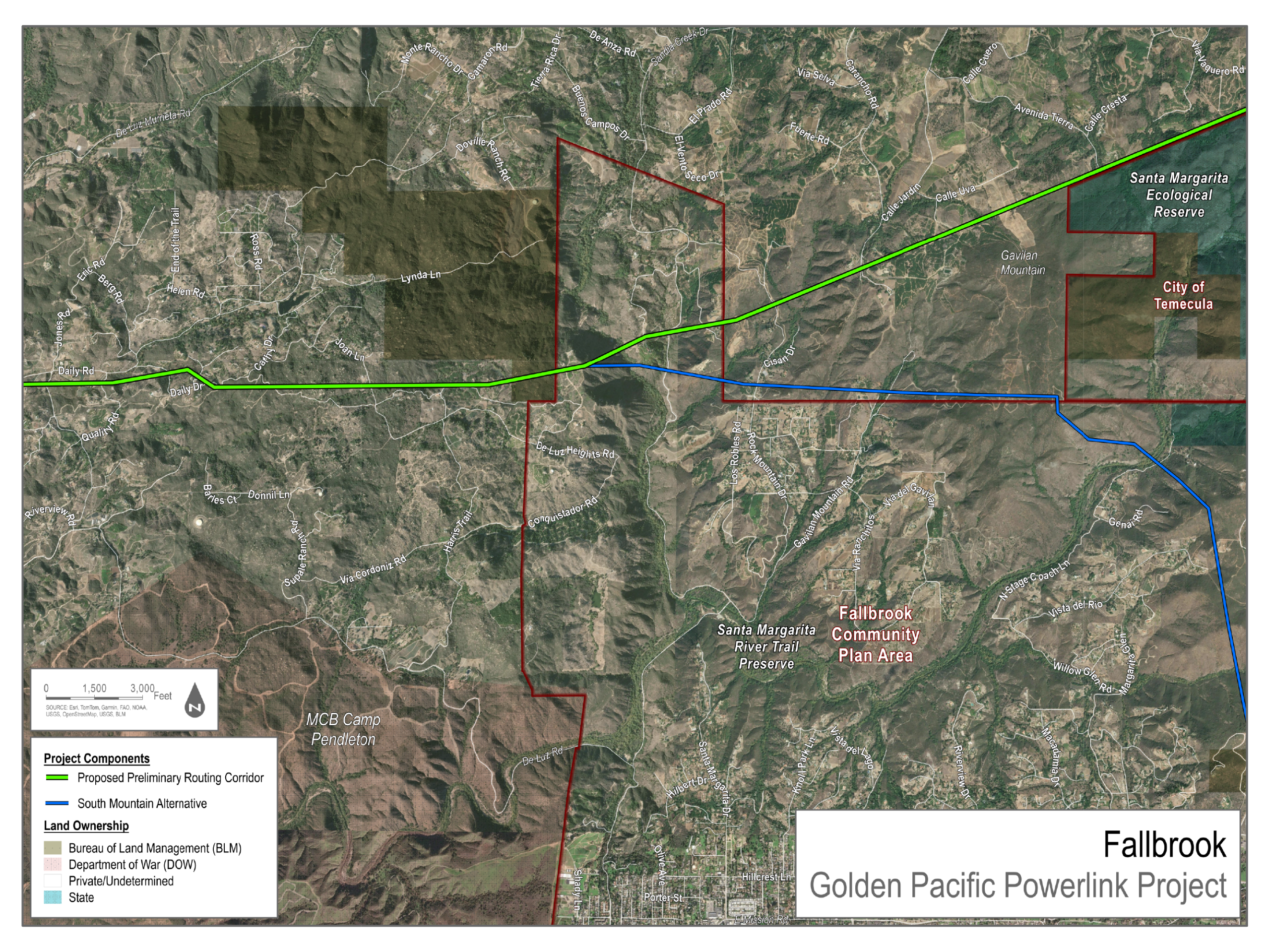
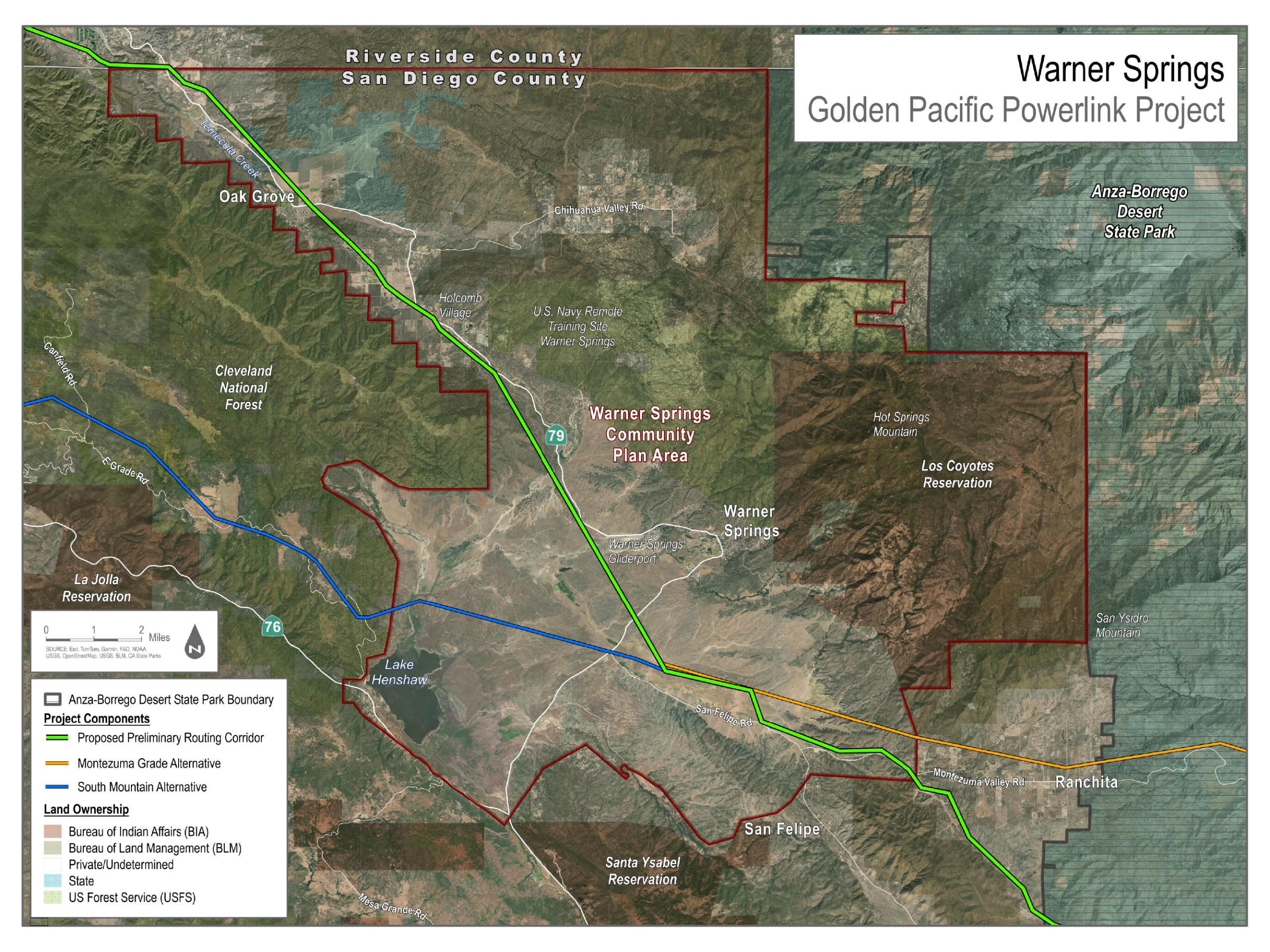
- South Mountain Alternative
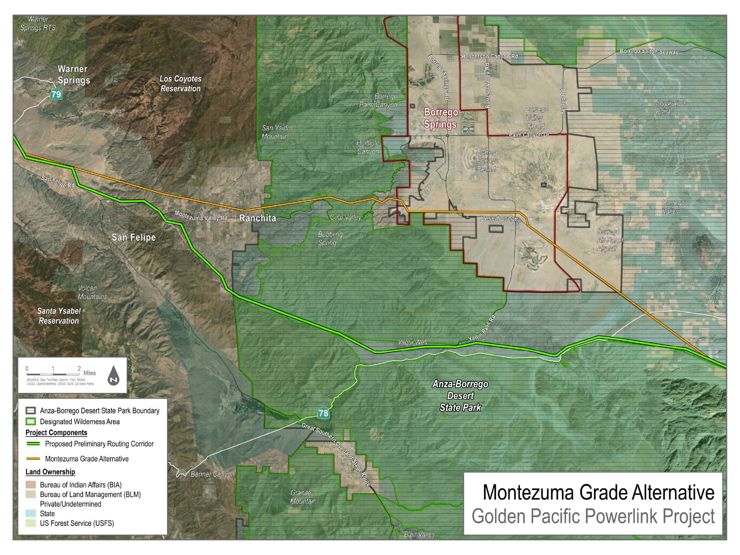
- Montezuma Grade Alternative
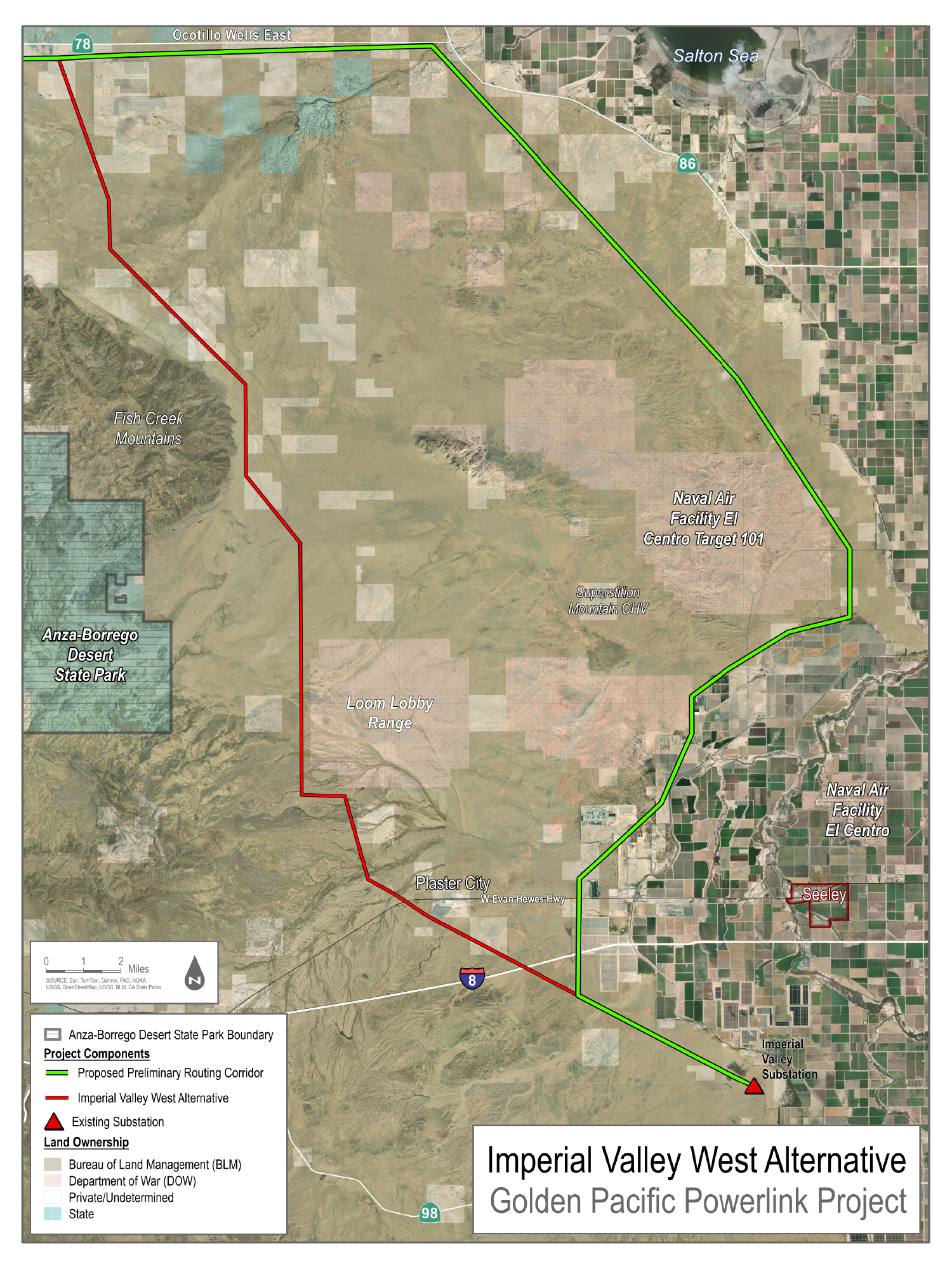
- Imperial Valley West Alternative
Drawn by SDG&E, not the hub. Its newest maps show the proposed route as a corridor 1,000 feet wide, and every route is still preliminary.
Fade them to see the ground underneath.
Loading the map…
What you are looking at
SDG&E's drawings, placed where they belong on the ground. The hub draws no line of its own.
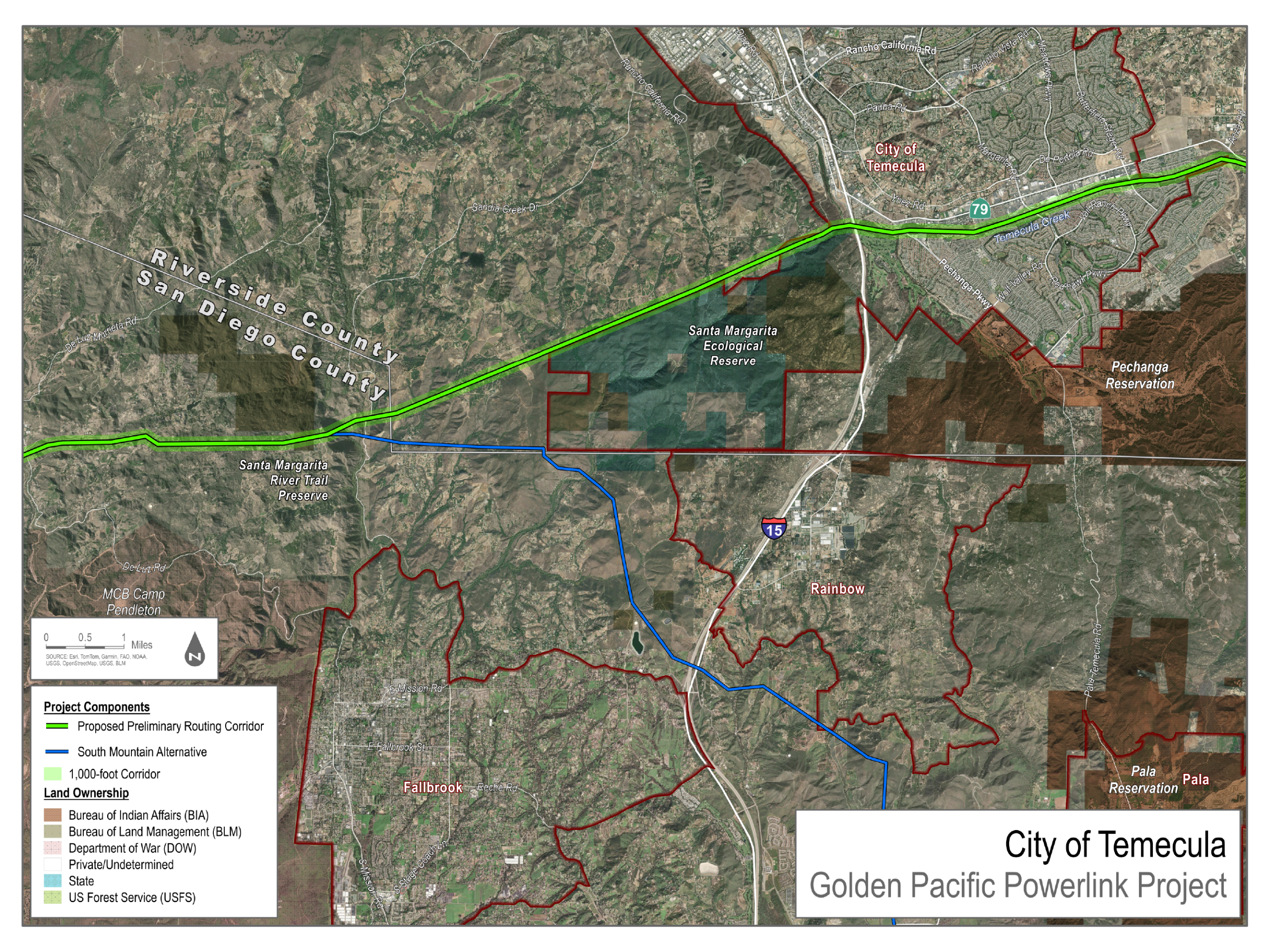
SDG&E publishes its route only as pictures: seven maps on its project site, with no map data behind them. Each colored line on this page is part of one of those pictures. The hub found where each picture belongs by matching the roads, ridges and buildings in it to U.S. Geological Survey aerial photos, then laid it on the map.
On SDG&E's six detailed maps the fit is typically within 15 meters, about 50 feet; on its overview map, within about 50 meters. Where two of its maps overlap, their lines agree to within about 25 meters, with the widest gap about 70 meters, between a September map and an October one.
The fit is not the uncertainty that matters. A line on SDG&E's map is a drawing of a preliminary route. Its newest maps show the proposed route as a corridor 1,000 feet wide, and any route can change before and after SDG&E files. Read the map as “about here”, never as a property line.
That is also why the map stops zooming in where it does: closer than that, SDG&E's pictures would look sharper than they are. If SDG&E or the CPUC publishes the route as map data, this page will switch to it.
Sources: Route Overview map (proposed corridor and three alternatives); City of Temecula map (Figure 7)
What happens to your address
- If you type it, your browser sends it straight to the U.S. Census Bureau's address finder, a free public service, and gets back a point on the map. It never reaches this site's server, so there is nothing for us to keep, log or lose. The Census Bureau receives what you typed, as it would if you used its own site.
- If you use your location or tap the map, your device works out the spot itself. Nothing about it is sent anywhere.
- Nothing is saved. Not in your browser, not in the page's web address, not in a cookie. Close or reload the page and the pin is gone. Sharing this page shares the empty map, never your pin.
- The map pictures come from other servers, as with any online map. The background is from the U.S. Geological Survey, whose servers see which squares of map your browser loads. SDG&E's maps are served from this site.
SDG&E's maps, full size
The originals, as SDG&E posted them. Newer ones sit on top where they overlap.
- Figure 1: Route Overview
SDG&E, posted September 15, 2026
- Figure 2: South Mountain Alternative
SDG&E, posted September 15, 2026
- Figure 3: Montezuma Grade Alternative
SDG&E, posted September 15, 2026
- Figure 4: Imperial Valley West Alternative
SDG&E, posted September 15, 2026
- Figure 5: Fallbrook
SDG&E, posted September 15, 2026
- Figure 6: Warner Springs
SDG&E, posted October 29, 2026
- Figure 7: City of Temecula
SDG&E, posted October 29, 2026
Save Pauma Valley has its own route map, in English and Spanish, tracing the South Mountain Alternative. For what the line is and where it stands, read The project.